

")
In the Dehcho region, Tthets’ek’ehdeli Got’ie (Jean Marie First Nation) has just issued an evacuation alert following a recommendation by NWT Fire. In the North Slave, NWT Fire and ECC recommended that staff at Rae Rock Mine evacuate. Three lodges near Campbell Lake remain at risk.
Officials cautioned of smoke impacting visibility along Hwy 6. Crews cautioned that dry conditions continue across NWT which mean fires can spread quickly.
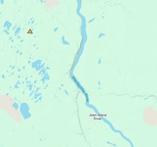
DEHCHO REGION
In the Dehcho region, Tthets’ek’ehdeli Got’ie (Jean Marie River First Nation) has issued an evacuation alert following a recommendation by NWT Fire.
Officials are cautioning Jean Marie River residents be prepared to evacuate on short notice
“Residents of Jean Marie River should be ready to evacuate on short notice due to a wildfire in the area. This is currently an alert to prepare. If you need to evacuate, an order will be issued with further information,” said Jean Marie First Nation officials in a post on social media today.
Officials are asking community members to go to GNWT’s Public Safety webpage
https://www.gov.nt.ca/en/publi
https://www.gov.nt.ca/ecc/serv
and to check with the Band Office regarding any questions about the alert.
“In addition, check Facebook regularly (this Facebook page) and stay in communication with the Band Office, for updates,” said Jean Marie FN officials.
“We are working on getting the radio station up and running, so keep your radios on as well, please. We will do our best to provide notices, but we ask that everyone plays their part in helping to stay informed as well,” added Jean Marie FN representatives.
A naturally caused wildfire (FS019), remains less than one hectare in size and is considered held, located about 6 km south of Sambaa K’e is.
“Wildfire crews as well as 802s are working on containing the fire and bucketed it (Saturday),” said officials.
About 18 km northeast of Sambaa K’e, Fire crews continued an active response to protect area structures from a wildfire (FS018) first spotted on July 1.
“This lightning caused fire is approximately 40 hectares in size. There are cabins in the area that crews are working to protect. 802s made drops to cool the perimeter and are blacklining around the area to ensure there is no more fuel to burn through. There are no threats to the community of Sambaa K’e or infrastructure in the area at this time.,” assured Fire officials.
Fire crews from the Yukon joined NWT Fire crews earlier last week to contain the number of fires (FS002, FS006 and FS009) in the Liard Complex.
“This fire is being hit hard with air tankers,” said crews.
There are no immediate threats to communities or infrastructure, assured officials.
Firefighters continue to respond to a wildfire, located approximately 23 km southeast of Fort Simpson and 24km northwest of Jean-Marie River (FS014).
“The Northeast corner of this fire is particularly active, but wildfire crews, 802s and helicopters are working to contain it. They are bucketing the fire today. Residents of Jean Marie may see smoke around the area coming from this fire,” said Fire crews.
NORTH SLAVE REGION
Dawn Keim, acting senior manager of the contaminants and remediation division of Crown Indigenous Relations and Northern Affairs Canada, confirmed that at about 3 p.m., Rayrock site personnel began evacuating as a precautionary response.
The Rayrock Project team said that evacuations of the 36 personnel to Yellowknife are safely underway.
“The Kwetįįɂaà (Rayrock) Project team can confirm that evacuations of the 36 personnel to Yellowknife are safely underway, in accordance with the Project’s Emergency Management and Fire Protection Plan. These began on Saturday evening and continued on Sunday, with essential personnel remaining on-site to action shut-down procedures,” said Keim.
Officials expect everyone will be evacuated by end of day today
“The Project team has suspended work at Rayrock until it is safe to return to the site. The Project does not anticipate any impacts to the environment as a result of the suspension of activities. The Project team is working closely with NWT Fire to monitor the situation,” said Keim.
In the North Slave region, staff at Rae Rock Mine continue a process of precautionary evacuation due to concerns about the effects of a nearby fire. The evacuation came after Fire and ECC’s recommendations due to a wildfire, located about 15 km east of Rae Rock Mine (ZF013) is being actively actioned on with an evacuation order recommended by NWT Fire and GNWT’s Environment and Climate Change team.
“ECC has recommended staff at Rae Rock Mine consider an evacuation as a precaution due to possible strong winds. The site is accessible by float plane only and the smoke in the area may pose a risk for planes to move a lot of people out in the future,” said NWT Fire.
This morning a representative from NWT Fire told True North FM that ECC’s recommendation is being supported by Fire officials.
Another wildfire continues to threaten three lodge structures in areas near Campbell Lake.
A wildfire (ZF024) near the south end of Campbell Lake continues to be aggressively actioned on by Fire crews.
“The fire is being reassessed at approximately 1500 hectares,” said NWT Fire in an update posted this morning on social media.
Officials reported that some area lodges remain at risk, with some notified of a potential evacuation order.
“Three lodges in the area have been alerted that they may be required to evacuate and structure protection has been started. Forecasted Strong southern winds could continue to push the fire closer to values at risk today and ECC is in touch with stakeholders to provide information and updates,” said Fire crews.
Firefighters continue another active, targeted response on a wildfire in the North Slave region, located about 3 km east of Watta Lake (ZF011).
“No values are assessed as at threat in the near future due to this fire. Assessments and consultations with owners in the area took place and plans are in place should this fire become a threat,” said NWT Fire.
Firefighters have continued to make steady progress on a wildfire (ZF009) located about 8 km southeast of the NICO Cobalt Mine.
“Crews have made great progress on this fire as it is 75 per cent contained,” said officials.
BEAUFORT DELTA REGION
In the Beaufort region, Fire crews continue mobilizing a response for number of fires.
About 20 km southwest of Fort McPherson a fire (EV019-25) can clearly be seen from the Dempster Highway.
“This fire is highly visible from the Dempster Highway. It is 112 hectares in size and crews are monitoring it,” said officials.
Crews assured that there are no threats to the community of Fort McPherson, highway access, or cabins in the area at this time.
Officials said that anyone who would like more information on this fire can contact the wildfire info line at 867-445-5484.
NWT Fire asks that people refrain from calling their local base, which has been overwhelmed by questions and requests for information connected to this fire.
Crews are also responding two more wildfires, located about 33 km east of Inuvik (EV016-25) and (EV017-25) about 37 km east of Inuvik, which have merged.
“(The wildfire) is now about 1400 hectares in size. 802s are currently working on the west flank of the fire. There are no threats to the community or other values at this time.,” said officials.
About 15 km southwest of Fort McPherson, another wildfire (EV021-25 ) has increased from 32 hectares in size to 152 hectares.
“This wildfire is 152 hectares. Due to safety concerns with the terrain, wildfire crews are not working directly on it at the moment, but are monitoring the fire, the highway nearby and any values at risk north of the fire. People may see smoke around Fort McPherson and along the highway,” cautioned NWT Fire
Officials advised residents to be aware fo smoke in the area and to keep updated through the territorial drive advisories webpages https://drivenwt.ca.
SOUTH SLAVE REGION
In the South Slave region, a fire reported yesterday (SS013), located about 6 km south of Hwy 6 and about 7.5 km north-northeast of Hwy 5 has grown by about five hectares in the past 24 hours..
“This lightning-caused fire is approximately 30 hectares in size. Crews, a helicopter and air tanker are working to hold the northern flank to prevent it from getting closer to highway 6.,” said NWT Fire.
Officials advised residents to be aware fo smoke in the area and to keep updated through the territorial drive advisories webpages https://drivenwt.ca.
Officials cautioned that the territories remain in drought, which means fire can travel quickly.
NWT Fire urges residents to be mindful of campfires and ensure that any fires are fully extinguished.
“Human-caused fires can pull resources from other fires as they are often closest to the things we care about. ALWAYS SOAK-STIR-SOAK your campfire!,” urged Fire officials.
Currently, the city of Yellowknife and the town of Hay River, along with a number of other communities in NWT remain under a fire ban.
(NWT WILDFIRE UPDATE – July 6, 2025; 6:00PM, posted on social media by NWT Fire July 7)

