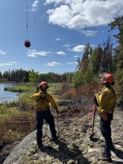
There are 13 new wildfires active in the NWT as of Sunday evening, with heavy smoke expected to continue in the Dehcho region.
Officials cautioned that extreme fire weather conditions and continuing lightning are expected in the territories.
NWT Fire assured that the wildfires are being monitored and do not pose a danger to communities.
In the North Slave region, two new wildfires are reported, including a new fire (labelled ZF011-25 by officials), which is located about 82 km east-southeast of Yellowknife and east of Watta Lake, estimated to be about 25 hectares in size and is classified as out of control.
“Airtankers worked the fire Saturday, June 28th and structure protection will be established as needed,” said NWT Fire.
Another new fire is located about 3 km south-southwest of Highway 4 and the Cameron River Crossing Territorial Park. The fire (ZF010-25) is lightning-caused and is estimated to be less than a hectare in size. The fire is classified as under control.
“Airtankers worked the fire Saturday, June 28th and crews actioned this fire further. There is currently no risk values in the area,” said NWT Fire.
Another lightning-caused fire (ZF009-25), which began on June 27, is located about 8 km southeast of the NICO Cobalt Mine and 3 km east of Marian River. This fire is estimated to be about two hectares in size and is classified as out of control. NWT Fire reported that the fire does not pose risks to the community or to values.
In the South Slave region, one new lightning-caused wildfire (SS010-25) was reported 12 km west of Highway 1. The fire is estimated at less than one hectare in size and is considered out of control, said NWT Fire. Fire Crew and a helicopter are actioning this fire. Officials reported that the fire does not pose risks to the community, structures or cabins.
In the Sahtu region, there are three new lightning-caused fires as of Sunday evening, including one (VQ008-25) located about 72 km west of the Mackenzie River that is approximately 180 hectares in size and considered out of control. As of NWT Fire’s latest report, there is currently no risk to the community, structures or cabins in the area. Fire crews are continuing to monitor the fire.
Another lightning-caused fire in the Sahtu (VQ009-25) is located about 139 km west of the Mackenzie River and is estimated to be about 65 hectares in size. The fire is considered out of control and is being monitored by Fire crews. NWT Fire said that the fire currently poses no risks to the community, cabins or structures.
About 98 km west of the Mackenzie River and Norman Wells, a new lightning-caused fire (Q010-25) is estimated to be about eight hectares in size and is considered out of control. Fire crews are monitoring the fire and assured there is no risk to the community, structures or cabins in the area.
NWT Fire reported yesterday evening that another lightning-caused fire in the Sahtu, located about 9 km southwest of Fort Good Hope and 5 km south of the Mackenzie River, is approximately 65 per cent contained. The fire began on June 27 and is about 2 hectares in size at its last measurement. Fire crews are in the process of installing a cold trail around the perimeter. NWT Fire reported that structure protection will be installed as needed.
In the Beaufort Delta region, there are seven new lightning-caused wildfires reported as of Sunday, including one (EV008-25) located about 47 km southeast of Inuvik and west of North Caribou Lake. The fire is estimated to be 30 hectares in size. The fire is being monitored by Fire crews. NWT Fire said that the wildfire currently poses no risk to the community or values in the area.
Another fire (EV009-25) located about 5 km east of Dempster Highway Mile Marker 200 is estimated to be less than one hectare in size and is considered out of control. NWT Fire reported that Air Tankers actioned on the fire on June 28 and said that the fire does not pose a risk to the community or values in the area.
Also in the Beaufort Delta region, a new wildfire is located about 40 km north of Inuvik, and 18 km west of the Inuvik to Tuktoyaktuk Highway. The wildfire (EV014-25) is estimated to be about 5 hectares in size. Fire crews are monitoring the fire and responding as needed.
“Air attack has started and crews are on their way,” said NWT Fire.
Officials assured that the fire does not pose a risk to the community or values in the area.
About 10 km east of Arctic Red River, another new wildfire (EV011-25) is estimated to be about one hectare in size. Fire crews are monitoring the fire and assured that the fire does not pose risks to the community or values in the area.
Another fire located about 14 km east of Highway 8 and 15 km west of North Caribou Lake, which began on June 27 remains about 1 hectare in size. The fire is considered out of control and is being monitored by Fire crews. NWT Fire reported that the fire does not pose risks to the community or values in the area.
Two more new fires in the Beaufort Delta region are under one hectare in size. Officials assured these fires do not pose risks to communities, structures or cabins. One is located about 2 km east of Dempster Highway Mile Marker 178 (EV012-25). Officials reported that air tankers actioned the fire on June 28. Another fire (EV013-25), under one hectare in size, is located about 15 km east-northeast of Fort McPherson and 1.5 km northeast of Dempster Highway. After a response by air tankers and crews, the fire is held.
Officials advised anyone who would like to learn more about where smoke in their area is coming from to go to www.firesmoke.ca
Heavy smoke continues in the Dehcho region. A lightning-caused fire (FS014-25) which began on June 27 in the Dehcho is about 800 hectares in size, according to last measurements and is considered out of control.
“Air tankers and helicopters continue their attack to suppress the fire’s growth,” said Fire crews. There is no risk to the community, cabins, or infrastructure at this time.
Another wildfire (FS007-25) is located about 18 km northeast of Wrigley and 1km north of Hodgson Creek.
“The crews fighting this 1010-hectare fire continue work on the valley floor aided by aircraft. Community protection efforts are ongoing, with sprinkler systems in place throughout town,” said NWT Fire.
Officials said that currently there are no evacuation notices, alerts or orders in place related to this wildfire.
In the South Slave region, the Tulip Lake wildfire continues to maintain a status of under control The wildfire covers an area of about 14,167 hectares. NWT Fire crews have ended the unified command with other Fire jurisdictions and are continuing to combat the fire.
“NWT Firefighters focused their efforts on the northwest corner of the fire, identifying and extinguishing hot spots,” said officials.
NWT Fire is asking the public to pay close attention to fire danger weather alerts and to avoid campfires if fire danger is high or extreme. They urge the public to follow any fire bans in place.
A number of parks in N.W.T. have fire bans in place, including Wood Buffalo National Park, Hay River Territorial Park and Fort Simpson Territorial Park
For more information about fire danger and to access the live fire map along with detailed updates, head to www.nwtfire.com.
NWT Fire is asking anyone who sees any signs of wildfire to reach out and report it immediately.
“It is essential that if you see smoke, or what you believe to be a wildfire you call 1-877-698-3473 (877-NWTFIRE) right away before they grow. The quicker we find out the quicker we can action a fire,” urged officials.


