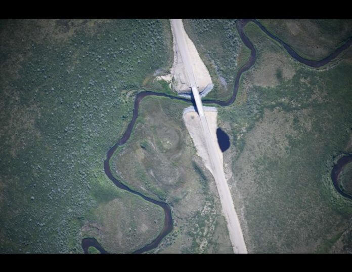
Canada’s first all weather-road to the Arctic got the paparazzi treatment from the Alaska Center for Unmanned Aircraft Systems Integration (ACUASI), which took over 60,000 photos as part of an effort to map the new road.
Photos of the Inuvik-Tuktoyaktuk highway, which first opened in November 2017, were captured in aerial photos by a remotely piloted SeaHunter aircraft, in one of the largest non-military remote sensing project of its kind, according to a statement from Jerald Pinson, a spokesperson for ACUASI.
ACUASI was commissioned by the federal department of Fisheries and Oceans. The federal government wanted a map of the 86-miles of gravel highway, as the road crosses a number of streams that support fish populations important to Indigenous communities in the region, according to Pinson.
“These fish fall under the purview of Fisheries and Oceans Canada, which wanted to find a way to safely and effectively monitor potential changes to freshwater habitats,” he said.
The photos also cover a large section of the adjoining Dempster Highway.
The plane would fly for up to 8 hours at a time. The plane was preferred over satellite imagery because of the detail that could be captured in the photos.
“Typical human piloted photo surveys are done at 20 to 30 cm pixel resolutions, whereas the highest resolution satellite imagery also comes in at 30 cm pixels,” Jurjen van der Sluijs, an unmanned aircraft systems coordinator with the Northwest Territories Centre for Geomatics, which collaborated on the project, said in a statement.
“With a resolution of 6 cm, the Inuvik-Tuktoyaktuk Highway imagery can therefore show more detail than what is otherwise available,” he added.
Once taken, the photos were then stitched together using a process called photogrammetry to create a detailed mosaic.
“Eyal had the dubious distinction of having to sort through sometimes terabytes of images,” Andrew Wentworth, Alaska Center for Unmanned Aircraft Systems Integration, University of Alaska Fairbanks, said in a statement.
ACAUSI had previously collaborated with Transport Canada to help with endangered whale monitoring in Canada’s busiest shipping lanes in the Gulf of St. Lawrence.


