
 10x14 (1)")
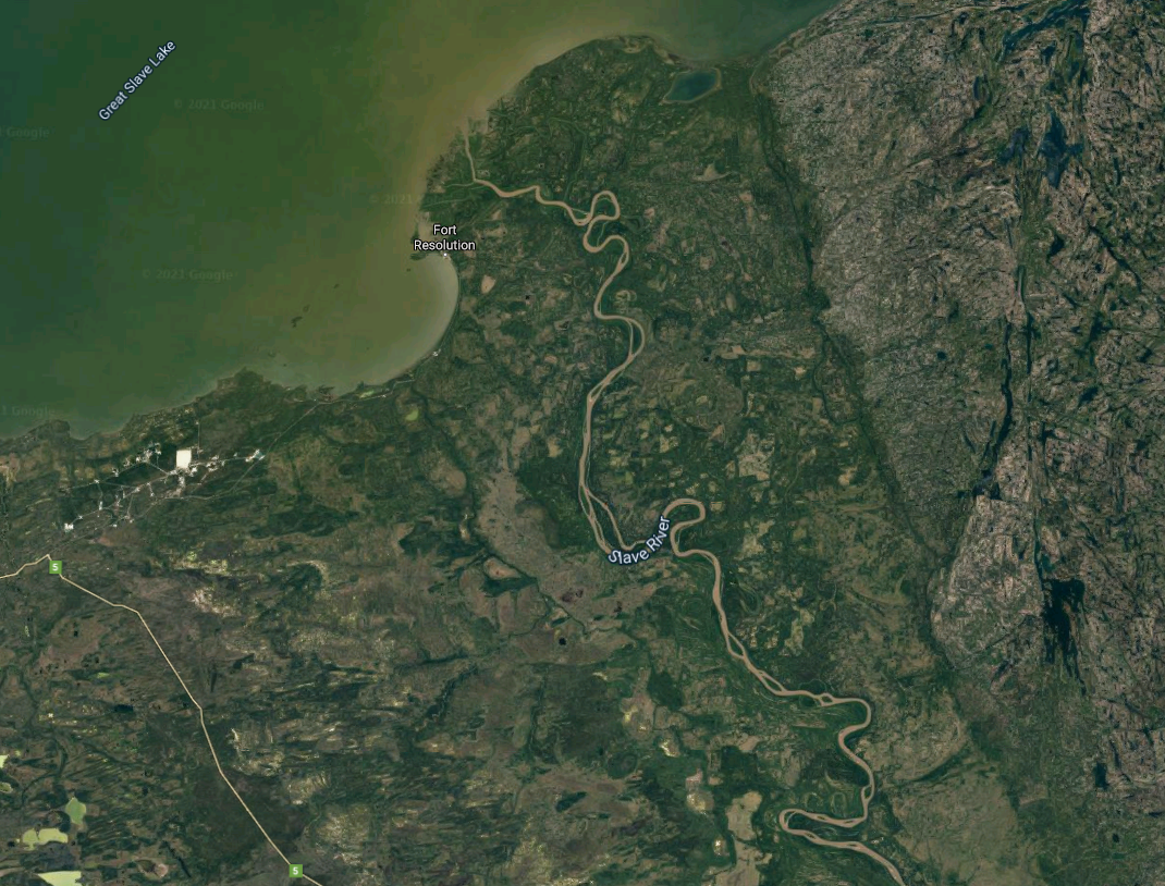
Water levels on Great Slave Lake reached the highest level recorded since monitoring began in the 1930s this past summer.
New research by a team of hydrological experts from the GNWT, the Alberta, B.C., Saskatchewan government found all major rivers feeding into Great Slave Lake also had higher than normal levels.
Flows were at or near record high levels for much of the summer on the Tazin, Taltson, Lockhart, Kakisa, and Hay rivers.
The research found that initial modelling suggests water levels on Great Slave Lake will not likely return to normal historical levels for an extended period of time.
This is down Taltson River 70 miles below the dam. They let water out 3 times October. November. December 2020 the…
Posted by Arthur Beck on Thursday, 21 January 2021
“This has been an unprecedented year for water levels in the Northwest Territories, including on Great Slave Lake,” Shane Thompson, Minister of Environment and Natural Resources, Government of the Northwest Territories said in a statement. “I recognize our residents have a lot of questions about what caused the high water and the role of the W.A.C. Bennett Dam.”
High water levels have caused problems throughout the territory over the past year.
Some residents in Hay River were issued evacuation orders after flooding risk reached dangerous levels back in May
High water levels along the Taltson River impacted hunters and trappers in the area, with some finding their cabins frozen in thick sheets of ice as water surged over the banks of the river and froze as winter came.
The Department of Environment and Natural Resources released a statement back in November that warned higher-than-usual water levels could continue into the winter, and could alter water and ice flows. Campbell said there are a number of factors that contribute to water levels and ENR is continuing to collect data.
“These water levels are unprecedented. Rain and snowfall in northern B.C., Alberta and Saskatchewan will be the biggest factors contributing to what water levels will be like in the NWT in future years,” Darren Campbell, Environment and Natural Resources said in an email in response to questions on the Taltson River flooding.
“Conditions this spring will depend on existing water levels, the amount of snow in the watershed, how quickly melt occurs and if rainfall occurs during the melt period.”
The problems were felt outside the territory. The Fond du Lac River in Saskatchewan reached near record high water levels.
In Alberta, Lake Athabasca reached the second highest water levels on record in 2020, and water levels in the Peace Athabasca Delta were also very high.
The problems were felt outside the territory. The Fond du Lac River in Saskatchewan reached near record high water levels.
In Alberta, Lake Athabasca reached the second highest water levels on record in 2020, and water levels in the Peace Athabasca Delta were also very high.
“Last spring was a difficult time for many residents of northern Alberta, with ice jams and high river levels causing damage in the Regional Municipality of Wood Buffalo and Mackenzie County,” Jason Nixon, Minister of Environment and Parks, Government of Alberta said in a statement.
“I recognize our neighbours to the north also faced challenges with high water in 2020 and that’s why I was happy to lend Alberta’s monitoring data and staff expertise to this hydrological analysis.”


